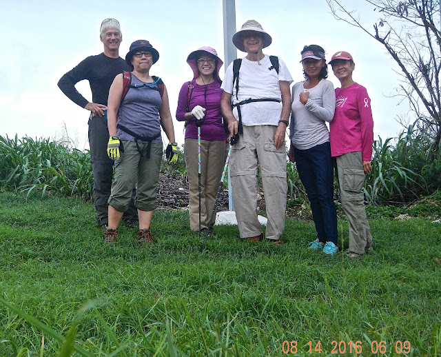
After being closed for nearly one year at the hands of Typhoon Soudelor, Kimikaze and Autobaun are finally reopened for hikers and bikers. Despite forecast of rain and wind, we decide to check out the trails. Sunday morning turns out quite nicely with some wind, but no rain.
Rexplorer, Giggles, Cutie, RedEye, Wonder Woman, CC.
Well, the trail doesn't look like much. We figure it will get better soon.
Part of the trail changes its direction and now hugs the rock face that displays a cascading root system.
Another new feature on the trail is an arch created by a fallen tree. The trail continues through the fern forest, several big trees, and eventually exits at the same spot, across from the Bird Island street sign that marks the start of Autobaun trail.
Autobaun Trail 1 follows the original track for some distance and then begins to veer toward the ocean. We suddenly come upon a view of Bird Island that appears so close that we feel we could almost walk down and over. But of course the trail is right next to a steep drop down the cliff, hence the edge is marked off with bright ribbons so bikers will not careen over the cliff!
A close up look of Bird Island's western flank.
Hermit crab and its stylish home.
Mushrooms are starting to pop up with the arrival of rainy season.
We have arrived at the end of Autobaun 1. This is where the Bird Island trail starts that goes to the beach. Autobaun 2 begins on the other side of this road. We decide not to continue on that segment. Instead, we head out to the main road where we will stop and have our snack time.
After our usual snack enjoyment, we head back up Kimikaze trail and back to the cars. Everyone agrees that the new trails are fun to hike on.
DOLOMITES, ITALY
From July 6 through July 22, four of the Saipan hikers spent two weeks hiking in the Italian Alps called the Dolomite. Thor, Sparky, Rexplorer, and Captain Charlie had a wonderful time climbing up and down the rocky and craggy, and sometimes snowy, mountains, and over green fields covered with wild flowers. Some hikes were very tough, others less so and simply breathtakingly beautiful. Here are just a few of the photos to share.
 Our first hike, climbing up and going through one of the WWI tunnels, the Lagazuoi Tunnel. The tunnel has a lot of ups and downs, sometimes with ladders, sometimes just steep slopes with hand rails. The photo on the left reminds us a bit of the Oba Cave, except this tunnel is 1.5 KM long! Thor looking on as Sparky and Rexplorer are busy taking photos.
One of the many long stairways in the tunnel. Tough on the knees! These tunnels are carved out of rocky mountains hundreds of feet above ground. This hike takes us about seven hours to complete.
Our second and longest hike, an eleven-hour trek to Croda Da Lago, gaining over 3000 ft, exhilarating and exhausting. Thor, Rexplorer, and Sparky stopping to chat with another hiker. We don't run into too many other hikers.
For this hike, we take a tram up to Ortisei, enjoy a cup of cappuccino and a slice of strudel, then walk up to Resciesa where people visit the large crucifix. The temperature is a bit cold, although Sparky still wears shorts.
Taking time out to join a guided hike through meadows, trees, and wild flowers, still with the majestic mountains around. Sparky and Thor are in the middle of the pack. The five hour hike is a relief from the rocky climbs. We also take a "herb" tour to find herbs growing wild along pathways and fields, and tasting delicious herb-mixed butter and bread. Yummy...
The day before we leave the Dolomites: On the way to Piz Boe, at Sass Pordoi (2950 m). Rexplorer seems to have shrunk. Look closer, he is standing below the little ledge. At the lodge terrace, the 360 degree view is so fantastic that it takes one's breath away.
One of the many "rifugio" or "Hutte", or Inn found at every peak and ridge throughout the Dolomite, so hikers can sleep, and eat. They have great food at reasonable price. When the weather is warm, most people sit outside to enjoy the fresh air and the view. This Rifugio Forcell Pordoi (2848 meter) is just below Sass Pordoi. We visit this mountain on our last day of hiking. We stay at the Rifugio enjoying ourselves while Rexplorer goes ahead and climbs up to Piz Boe at 3152 meters.
Thor and CC enjoy a moment in the snow. This is our last day of hiking. We leave for Munich the next day.


