Thursday, December 13, 2012

Forbidden Island

On a glorious sunny day, nine of the Sunday hikers meet at the entrance to LauLau Golf Course to form a three-car caravan for Forbidden Island. Bruiser and Jane move from their sedan, which will not do well at all on the rough road to the trail head, to Lee's SUV. After a rocking and rolling ride on the unpaved road, we park our cars beyond the trail head and walk back to the sign that marks the trail head. Climbing over the concrete foundation, we begin our hike. The trail has been washed out a lot more during the rainy season, so the walking is a bit rough.

Cutie starts her butt-walk down this steep slope. Handy waits for his turn. Note the beautiful orange light on the tree branches casts by the rising sun.

The group enters the boonies toward the next part of the trail.

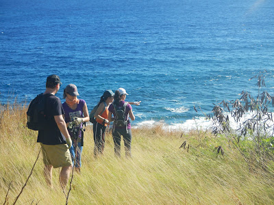
With golden sunlight illuminating the grass and the cliff, we are amazed at this beautiful view of the cove below. This cove is not accessible to hikers.  

The trail begins to drop steeply at several places. It's Colin's turn to butt-walk.

Gingerly making her way down this narrow crevice, Jane is followed by Bruiser.

Finally on the beach at low tide. This log looks like a huge baseball bat.

This rock looks like a giant walnut.

The swimmers change into their suits and enjoy the cool water in this swimming hole. They will probably stay in this pool for the rest of the day, but the rest of us are ready for our snacks!

Lee and Dora have been exploring in the shallow waters for little creatures. Being barefoot, they assist each other in making their way back to the beach.

On the way back up the cliff, we use this yellow rope to climb up.

While we are at the beach, a group of Russian tourists appear at the beach. We soon pack up to leave. As we are climbing up we can hear some hooping and shouting and note that the Russian group has crossed the pond and climbed up the Forbidden Island. Look closely at the four figures near the small clump of bushes.

Bruiser, Jane, Dora and Lee make a quick stop on the way up. Dora is pointing at the people on top of the island.

A great view of Forbidden Island from the lookout point at the top. Cutie and Bruiser resting by the rail.

A happy group. Standing: Bruiser, Marcia, Colin, SpiceGirl (newly christened hiking name for Lee). Sitting: Jane, Capt Charlie, Dora, Handy, Cutie.

Bruise plans to bring wine, cheese, and bread the next time he and Jane make the hike to Forbidden Island, rating this hike a definite Five Sneakers.

Thursday, December 6, 2012

Caves Exploration

 A happy group of hikers gather at the big taotaomona tree in Marpi, anticipating some exciting caving. Handy, Cutie, Chops, Dora, Bruce, Yurie, and Capt. Charlie gear up to find the first two caves off the Santa Claus Lane. The day is bright, cool, and dry, perfect for venturing into the boonies.

Bruce, Yurie (Jane), Cutie, and Handy on the dump road. We turn onto Santa Claus Lane, past the Ordinance Explosion ground. We miss the marking to the caves at first and walk further until we realize that the original ribbons and soft drink can have been removed from the trail head. We turn around and find the single ribbon on a branch. Eventually we spot a couple more ribbons and find our way to the first of the two caves.

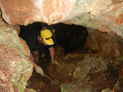
Jane, Dora, and Bruce, descend into the deep dark unknown. They have been warned to be careful and not go down too deeply, not knowing what is at the bottom and whether the air is clean.
 
Three joyful explorers returning from the bottom of the cave.
  
Jane extending a helping to Dora on the way down into the second cave. This cave runs horizontally under the big rock on the left. 

Into the pitch dark cave, once again, are the three explorers, Dora, Jane and Bruce. A strong flashlight reveals some left over items from the war. 

Bruce coming out of the cave, very satisfied with the discovery of this rare find.

The boonie area is quite overgrown. Many ribbons are worn out, or branches with ribbons have broken and fallen on the ground, and trails are lost. Fortunately we know we are not far from either exits. We exit back on the dump road. Dora and Bruce are still smiling and marveling at what they have seen in the caves.

When we reach the taotaomona tree for the next phase of the hike, we decide to take a break on the lawn. CC whips out the Christmas tablecloth for a well deserved respite.

Onto the next venture for the crevice at the base of Suicide Cliff. We decide to check out the concrete foundation that we have seen, but never visited, in our previous hikes to the crevice. We are surprised to find that the foundation is quite extensive and in good condition. A large metal container looks interesting and we are not sure what it is. 

After the foundation, we locate the trail. This bomb on the trail is marked with a pink ribbon. After this, the trail is lost in overgrown vegetation. Previously marked trail through the mother-in-laws field has completely grown over and impassible. We send Bruce to clear the trail, christening his hiking name "Bruiser". The growth is so thick that without a machete it is not possible to penetrate. We decide to circumvent the MIL field and make new trail, since we know the general direction of the cliff face.

We succeed in finding the trail to the "pottery barn" area. Just before we reach that area, CC is caught by a group of nasty boonie bees and is stung twice on her right arm. A quick swipe with a bee-sting wipe, she is good to go. The swelling will start soon. The pottery barn "party" site seems to have more shards and bottles. This sake bottle is actually marked in English.

Jane entering the crevice, with Bruiser ahead, wowing all the way at this unusual nature's creation.

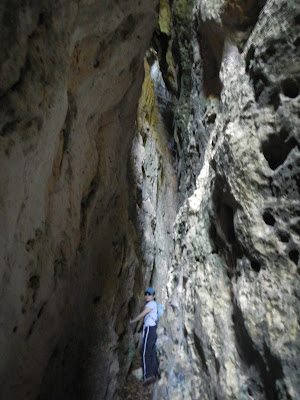
Dora is dwarfed by the crevice that extends skyward, at a rough estimate of at least fifty feet. A section of the crevice is so narrow that some people have to slide side way, or squat down a the lower part which is a little wider. Not a great place for anyone who is claustrophobic. 

Handy alerts us that he finds this hieroglyphic marking at the entrance of the crevice. What does it mean?

Having gone through the crevice to the other end and down the cliff face, we proceed to find our way back to the road. Since there are no markings, we basically blaze our own trail, realizing that eventually we will end up on the main road. Just as CC warns Jane to be careful about getting cut by coral rocks, CC herself gets scratched! Luckily Bruiser carries a first aid kit and provides ointment and band-aid for the wound. Soon we can hear the traffic down below, and as we near the base, we run into this large bomb. Handy is about the touch it but we all shout for him to stop, so he put his hand near it for a perspective of its size.

Back on the main road, we decide to take our group photo. Handy urges CC to show her band-aided leg. Nice photo.

A very enjoyable hike to the caves and the crevice. The weather is most pleasant and the caves are dry for exploration. Everyone agrees it is a five-sneakers hike.


Tuesday, November 27, 2012

Captain Oba's Cave

With two new hikers joining us, we meet up at the CHC parking lot, ready to tackle Oba's Cave. Handy, Cutie, Chops, Dora, Marcia, Bruce, Yurie, and Capt. Charlie load up for the hike. The early morning air is cool and clear. We march up Navy Hill, passing the turn offs to Grace Christian, Whispering Palms School, and Matsurana, continuing up the unpaved uphill climb, until we reach the gateway to the beautiful forest trail. The forest is lush and green, with huge birds nest ferns, bamboo groves, and old growth trees undisturbed by storms.

Yurie, brave as Tarzan's Jane, having a taste of her very first hike, hops over a fallen bamboo tree.

The massive and tall bamboo forest dwarfs the hiker. From here we enter the valley of damp and slippery rocks and boulders, with our gloves and sure footing, slowly descend towards the cave. Handy fell only three times, and Chops once, a pretty good record. We follow the Xterra signs, all the while amazed at how anyone could "run" down this treacherous trail. 

Handy, Bruce and Yurie looking up at us standing at the cave entrance.

Dora carefully steps into the dark cave tunnel.

Everyone is equipped with lights for the pitch dark interior. The cave is carved out in a U shape, about eight feet tall, ten to twelve feet wide in some areas. It has three entrances/exits, with only one that is easily accessible. One has to be impressed by the undertaking, especially done in such a difficult environment.

Dora and Bruce taking a look at the alternate exit and deciding that it is too difficult to make a big jump across a gap between the cave and the ground.

Chops and Handy (who has just picked himself up) navigate gingerly over the moss-covered rocks. Notice the shiny wet rocks in the foreground.

A well deserved snack break

A small group photo just after we makes a descend down some large boulders. This and the following two photos are kept in small size, as they are blurry when enlarged.

Handy getting ready to follow the group downhill.

A fuzzy looking group of hikers at the end of the adventure: Bruce, Yurie, Cutie, Handy, Marcia, Dora, Chops, and Capt. Charlie.

All agree that this is a super fun hike.  A definite five-sneaker rating.


Saturday, November 24, 2012

Banadero Trail 11/18/12

Happily we welcome Dora back to hike with us. Having been absent for months, Dora is quite happy too. 
This is our third attempt to conquer the Banadero Trail that goes from the Korean monument at Last Command Post up to the top of Suicide Cliff. Having failed twice, Capt. Charlie dispatches Master scout Chops as the advance re-con the previous week to re-discover the trail head. Her great height, long limbs and keen sense of direction succeed. 
An excited five-some gather at the LCP, walk around the Korean Monument into a tangle of bushes and branches and spot the first set of ribbons. The ribbons lead us toward the right, even though we are sure that the trail should be to the left. Nonetheless we push on and up.

All gloves on deck for hauling ourselves up the steep slope.

Cutie is keeping a safe distance from the person above, that is Chops, in case of loose rock slides.  Right now it is fairly dry, but birds nest ferns are in abundance.

A brief rest -

- by this cave. 

Finally we are able to see the proper trail, with some stone steps, and this lookout point. The water is blue, and the breeze is cool.

Concrete steps left over from the war still work well. Although we don't have real "seasons", leaves do drop during these fall months. 

Handy wants to make sure that this pink ribbon, glowing in the sun, is recorded for our blog.

It's hard to imagine we are hiking in a tropical island with this view of dried vines and crackling leaves. Peppy, aka Miss DeVine, had she been here, would not be able to pull any vines off the trees. 

A short distance up, Dora and Chops entering this tunnel of vines.

Along the trail is this concrete bench. Handy and Chops take a break with their precious hiking poles. CC encourages one of them to lie down and pretend to take a nap, but is unable to convince them to muck up their clothes. 

Near the top, a sad testimony of careless disregard for nature and environment.

Top of Suicide Cliff! A monument to honor several religions.

Fighting for the bag of Cheese Curls, Chops' favorite, but Dora has an iron grip on it.

Banadero Trail sign at the end (or the beginning) of the trail. It has partly fallen down. 

The only mushroom we discover on this hike. Quite unusual for rainy season when mushrooms should flourish in abundance. 

A fabulous view of the reef. 

This group of "crazy" hikers reclining in the middle of the road in order to catch the view of the ocean and the reef: Cutie, Handy, Capt. C, Dora, Chops.

We are always amazed at the beautiful view of the unspoiled hills and the ocean.

A dreamy look of Cutie and her umbrella.

Capt. Charlie does a few sit-ups at one of the circuit stations to wrap up the hike.

Although the hike is only 4.03 miles, it takes 3.5 hours. A five-sneaker hike.