Monday, February 27, 2012

Old Japanese Hospital

At 6 sharp on Sunday, Giggles, Peppy, and Captain Charlie welcome three new hikers on the driveway: Riema, Jason, and Celia. With sunrise appearing earlier now, we are able to begin our hike up Savana Road without flashlight. Our plan is to hike to Egigi Road that leads to the old Japanese hospital, then to Kingfisher, up Xterra and back to the driveway. Unbeknownst to us, we are in for a long haul!

A miscalculation by Capt. C. leads the group down Talofofo Rd. at Tun Goru instead of continuing further on Isa Dr. before turning down Talofofo at the bus stop. At this point, all innocent parties are still quite happy!

After turning onto Egigi Road, the realization that we are actually taking the very long way to the hospital dawn on us, we decide to take a snack break. Peppy shows off Giggle's new-found mini mixed nuts.

More than five miles later, we stop to chat with Baby at her nursery. She has a large mountain apple tree with lots of apples and she has no interest in selling them. We help ourselves to the refreshing and sweet tasting fruit and take a bagful with us.

A soul-mate for Cutie. Jason brings an umbrella to protect himself and Celia not only from the rain, but also from the sun. A loving couple. We are near the hospital now, on Gaga Kanisu Dr.

After getting permission from the property owner on whose land we have to pass in order to enter the hospital trail, a surprise at the entrance. A table full of war relics, including machine gun, machete, bullets, helmet, canteen and bottles, being displayed. Not sure where they have come from, but it is sure interesting to see them up close.

Fantastic view of the bay and Kagman in the distance. The entrance to the hospital is situated between two hills. The hospital is hidden on the right.

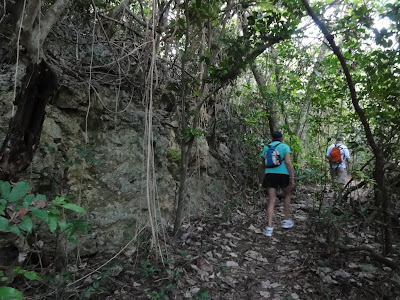
As usual, we keep our eyes open for mushrooms, especially in the shaded and damp areas. The trail down into the cave is perfect for many types of mushrooms. These little ones look like half shells. The trail down is rocky, slippery and narrow. One wonders how the medics were able to carry the wounded through this treacherous path without doing further damage. 

Further down the trail is this group of beautiful brown mushrooms blooming like flowers.

Hidden in the large cave is the hospital. This is the table at the entrance. Behind the rock wall is a large "room" where beds were probably set up for treatment. We very carefully climb into the cave without making much noise, respecting the spirits that reside here.

Prayer sticks and a small offering inside the "room". Ramnents of ashes from incense burning.

On the way out, we see another group of interesting mushrooms, looking like dark brown helmets.

A lone parasol-looking mushroom sticking out from an old rotted trunk.

After the hospital visit, and before we rest, we see that two swings conveniently located at the lawn for a group photo of Riema on the swing, Celia, Jason, Giggles, Peppy on the other swing, and Capt. C.

While we snack, Giggles models her new raincoat, an eco friendly and attractive number made out of a heavy duty, black, 33-gallon trash bag. Good job!

Knowing that we have a long way remaining to go, we spread out the snacks to reinforce ourselves before the long march home. With nearly another five miles to go, back to Egigi (thank goodness it's downhill), then up and up and up to Kingfisher, and up and up and up Xterra. We finally stumble back to the driveway, get ice water, and coffee.

Peppey's JogTracker shows that we have hiked 9.8 miles, spending 4:24:30 hours, averaging 2.22 miles per hour (don't forget we have taken time out to rest and explore), and BURNING 990 calories (is that for everyone or just Peppy?), and gain total alttitute of 1520 ft.

Original hike distance has been calculated at about 7.5 miles, but with CC's forgetting the correct turn-off, we have had to double back on Egigi. The last two miles of going up Talofofo and Xterra are the real killer miles. Several hikers get cramps, painful hips, dehydration, and sore toes. Even though the hospital is an interesting destination, due to the hardship, the hike is rated at three sneakers!
Next Sunday's hike is chosen: Banaderu Trail up to Suicide Cliff.

Sunday, February 19, 2012

Tinian Pika Festival

We hear the call of Tinian and follow our sense of adventure. The Stars and Stripes, working with MVA, Tinian mayor, and Don Fareell, to promote the Pika Festival, and to help plant the seeds of a future Tinian bike race, offers a special trip for bikers, hikers and all interested folks for a round trip sailing to Tinian for $49. Passengers can bring their bicycles on board, and stay at the Dynasty for a special rate as well. Peppy, Capt. Charlie,  Rexplorer, Doc H., Mary and Linn, and a bunch of other people, sign up for this good deal and a fun-sounding trip. We pack our bikes and luggage and meet up with everone else at 5:30 a.m at the Outer Cove on Saturday morning. The boat leaves the dock at 6 a.m. CC prepares for rough seas with a doze of Dramamine and a good thermos of coffee. Three hours later, we are docking on Tinian.

We are met by girls offering each passenger a seed lei, a welcoming water supply truck, and curious onlookers, as we unload our bikes and luggage. My camera is not used for the next several hours as forty some odd bikers sign the release form, have our legs marked with a number (mine is 33), fill our camel bag with water from the water truck, get on our bikes and start our ride immediately. Our luggage will wait for us at the hotel after we finish our ride. Unbeknownst to us, the ride is long and hot. We start at the heat of 9:15 a.m. I soon realize that the ride that is touted to be a "piece of cake" because Tinian is a FLAT island, is a total myth. As we continuously climb slope after slope, through freshly cut trails that are bumpy, slippery, and the sun is beating down mercilessly, we curse under our breath, and finally decide to turn off the trail and get back on the road. We wind through the village to enjoy the solid ground and quiet neighborhood, and back to the hotel. Peppy goes off toward the airport and makes her way back a while later. Rexplorer finish the whole course in four hours and exhausted. Doc does his share of sweating and hard work in the heat. Aspers have brought their grand kids so they ride to the hotel from the dock. Despite CC's complaint, the ride is great. There are much possibilities for hiking as well.

Mary and grand enjoying the cool pool at Dynasty.

After cleaning up and eating a big lunch, we head over to the Pika Festival for some loud announcements, food and watch lots of kids enjoying this special day. One event is pig catching by a bunch of boys chasing and then piling on top of the poor squealing animal. Winner gets $100. Also on the program are chicken and rooster catching...

Lots of hot peppers. Also on display are hot pepper bouquets.

A crowd-pleasing ladies hot pepper eating contest. Each person has 100 little hot peppers, a plate, and a bottle of water in front of them. They are to pop the pepper in their mouth one at a time, chew it a few times and spit it out onto the plate. At the end of 3 minues, the one who chews up most hot peppers wins! There is a judge in front of each contestant to make sure that every pepper is chewed before spitted out. It's painful to watch!

The Winner! She chews up 97 peppers. The painful look on her face atests to that feat. A good cooling and soothing remedy is vanilla icecream and milk!

CC gets really excited to hear the announcement for pika popcorn. There is a choice of Pika for mild, Pikaka for hot and Pikakakaka for 911 HOT! CC orders a Pikaka popcorn and waits around. Unfortunately the microwave is not working and the corn never popped! Disappointment!!! 

Sunday morning we rise and shine for a ride to Suicide Cliff at 6:30, on the south-eatern tip of the island. It is nice and cool and breezy. Stopping for a group photo are Dick Pierce, Peppy, Doc H, Rexplorer, and Capt. C. 

Peppy and CC takes a break in front of the memorial for all the dead at Suicide Cliff. Notice the rising cliff in the background. That, is the testimonial that Tinian is Not Flat.


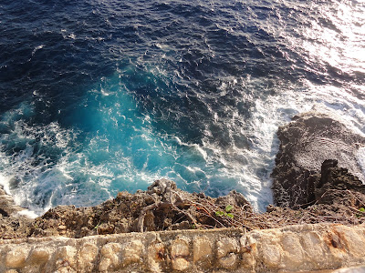
Looking down over the wall where the Suicide Cliff gets its name. It is more like the Banzai Cliff on Saipan. It does give one the shivers to look down at the unavoidable rocks and the boiling sea below for anyone who jumps.

View from Suicide Cliff toward Puntan Kastiyu.

A trio of happy and colorful bikers!

House of Taga Historical Site. Very impressive Taga stones and a new sign board of photos and pictures and story of Taga legend. These stones are huge.

Rexplorer standing beside the stones gives one the perspective of how large the stones are.

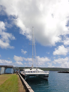
Stars and Stripes ready to pick us up Sunday afternoon.

Bikes inside the cabin, well protected and strapped down.

Even the bags look tired and ready to go home!

Peppy can atest to how tired we all are. CC wakes just long enough to take this photo! :-)

We are all glad to have taken this special offer and to have spent the weekend on Tinian as some of us have not been there for quite a while. It is larger than we thought and the island has more parks, palapalas and picnic areas than the population can possibly utilize, a perfect place for more visitors...Peppy, Rexplorer and CC are already thinking of a bike/hike trip for the SundayHikers in the near future!


Sunday, February 12, 2012

Obyan - Naftan

On a sunny morning, Chops and Capt. Charlie meet up with Handy at the airport parking lot. Handy has just sent Cutie off to Japan and decides that since we are starting today's hike at Obyan beach, he will just wait for us at the airport. From there the three of us head over to Obyan. Missing in action today is Giggles who is bike racing, Peppy, who is recovering from a Saturday function, Superman and Wonder Woman who are busy with their business.
From the parking lot of Obyan, we trudge up the steep rocky road and take the first right turn for the Lower Road to find the connecting trail to the Upper Road. The trail head is well marked with an Xterra sign and several ribbons:
A well-marked sign that leads to the crossing from Lower Road to Upper Road. CC ties one of her pink polkadot ribbons to add to the already crowded field of ribbons.

Handy proudly points out a huge tao-tao-mo-na tree on the cross trail.

Handy and Chops lead the way through the cross trail that looks like an old road with several off shoots of flat trails that seem to indicate some busy traffic in the past.

At the end of the cross trail, we take a right turn on the Upper Road that eventually leads us to the big gun at the southern tip of the island. Handy takes a rest on the low wall and surveys the area around the big gun and laments that it should be cleared and cleaned up for a more attractive tourist destination.


The dynamic trio of Chops, Capt. Charlie, and Handy.

CC produces a new tablecloth, rather appropriate for Valentines week. We take our time having  a good and relaxing rest period, eating and enjoying the cool breeze, blue sky and quiet solitude.  

Looks like Chops and Handy are having a leg fight and Capt. Charlie is trying to stop them and mediate for a peaceful resolution. Or, maybe the three of us are just so "bored" that we have to show off our "beautiful" legs!


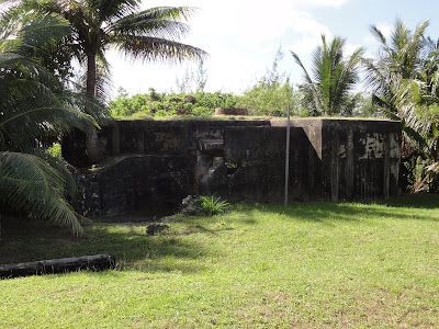
We explore around another trail off the big gun and find this structure that may have been an ammunition storage "shack". We find another one later further down the trail.

Coming to the end of the little trail with two storage "shacks". This is the southern tip of the island. There is a white truck parked on the trail and seems like someone is out fishing by the cliff, although we have not seen anyone out here.


Handy taking a close look at this plant and wondering what kind of tree this is. Chops promises to check it out and let us know what it is. It has a plumeria trunk and branches, and waxy leaves.

To accomplish her mission, Chops takes a branch home to plant and study.

On the way out, we find this large shell casing on the ground.

Back on the crossing trail to the Lower Road, CC ties a ribbon to mark the barbed wire for hikers and bikers.

View of the southern most tip of Saipan, looking from the coral road going back down to Obyan Beach.

Back to Obyan, the old German style bunker is well-kept and quite clean. We meet up with a couple who want to find out more about hiking on the island. Handy and I give them lots of information.

Inside the bunker. Don't know what those rectangular indentations are for.

Obyan Beach is very nice and cool for picnic and relaxation. The beach is big and can hold several picnic parties. The parking lot is also big and can hold quite a few cars. There is a guard on site daily from nine to six.

Can we have more of these around the island?

This has been a very pleasant hike, it's beautifully sunny yet cool. We take our time at a leisurely pace. The trails are all quite flat, so there is no challenging rock climbing. We explore a little bit, and it is very enjoyable. For this, we rate this hike:

A Four Sneaker!

Today's Frankenstein's Speak: Eli Inis (Guess what that is for!)