Tuesday, May 20, 2014

Radar Hill

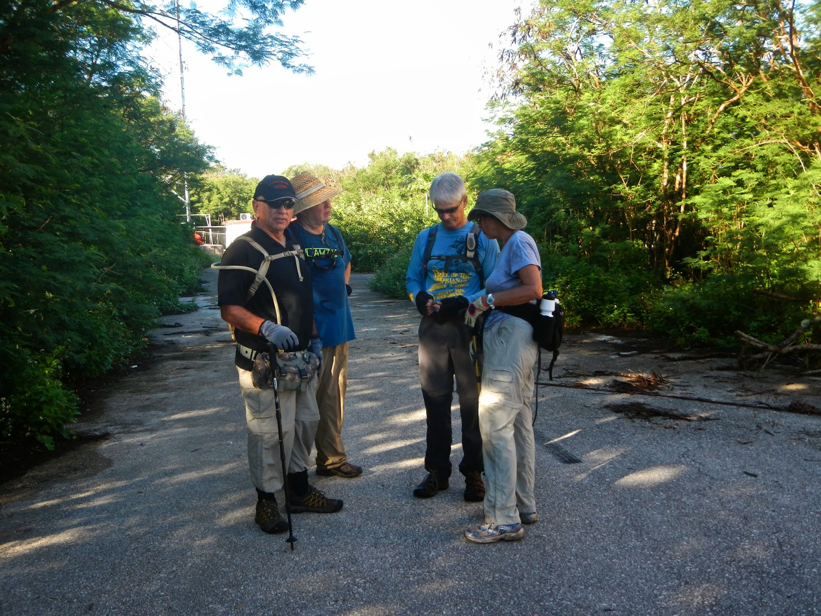
Having found a new trail up on Radar Hill recently, we decide to hike it with the Sunday group. Notices go out early, on Sunday morning, we five show up at the "parking lot" by Marker 16 of Laderan Tangke trail, at 6:15: Thor, Sparky, Ewok, Rexplorer and CC. From there we walk out on the .65 mile trail to Marker 1, the front entrance of the L.T. trail. Continue from there we walk to the main As Matuis Road.

We head up the hill toward Radar Hill, we notice an old concrete wall and remnant of a building. 

A small detour through the boonies brings us back to the road. Ewok emerges from the bushes.

Almost to the top of the hill is an opening to a sunken platform. Sparky, Ewok, and Thor stand on the top of the steps, while Rexplorer and CC go down to the platform to inspect. 

The sunken foundation has sloping walls on all four sides. We are not sure what function this structure serves.

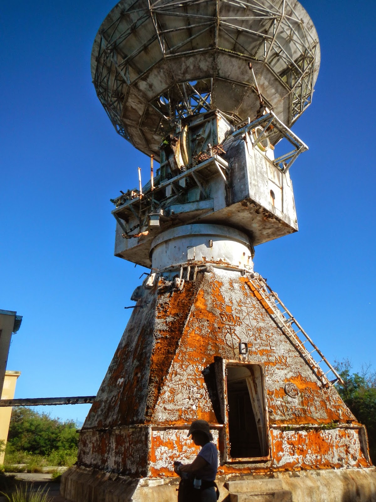
At the top of Radar Hill, behind Ewok, is the abandoned radar station.

Strewn on the ground, like a bunch of dried seaweeds, is this bundle of old tapes. Makes one wonders what is on the tapes.

Built in the 80's, this is Reagan's Star War installation of a strategic missile defense system. It created a number of jobs, and the building of a nice road from just north of Fiesta Mall. Nowadays the road is one of the favorite rides for bikers. The station is abandoned and rusting away. The location has seen some crimes committed.

They discover something on the ground.

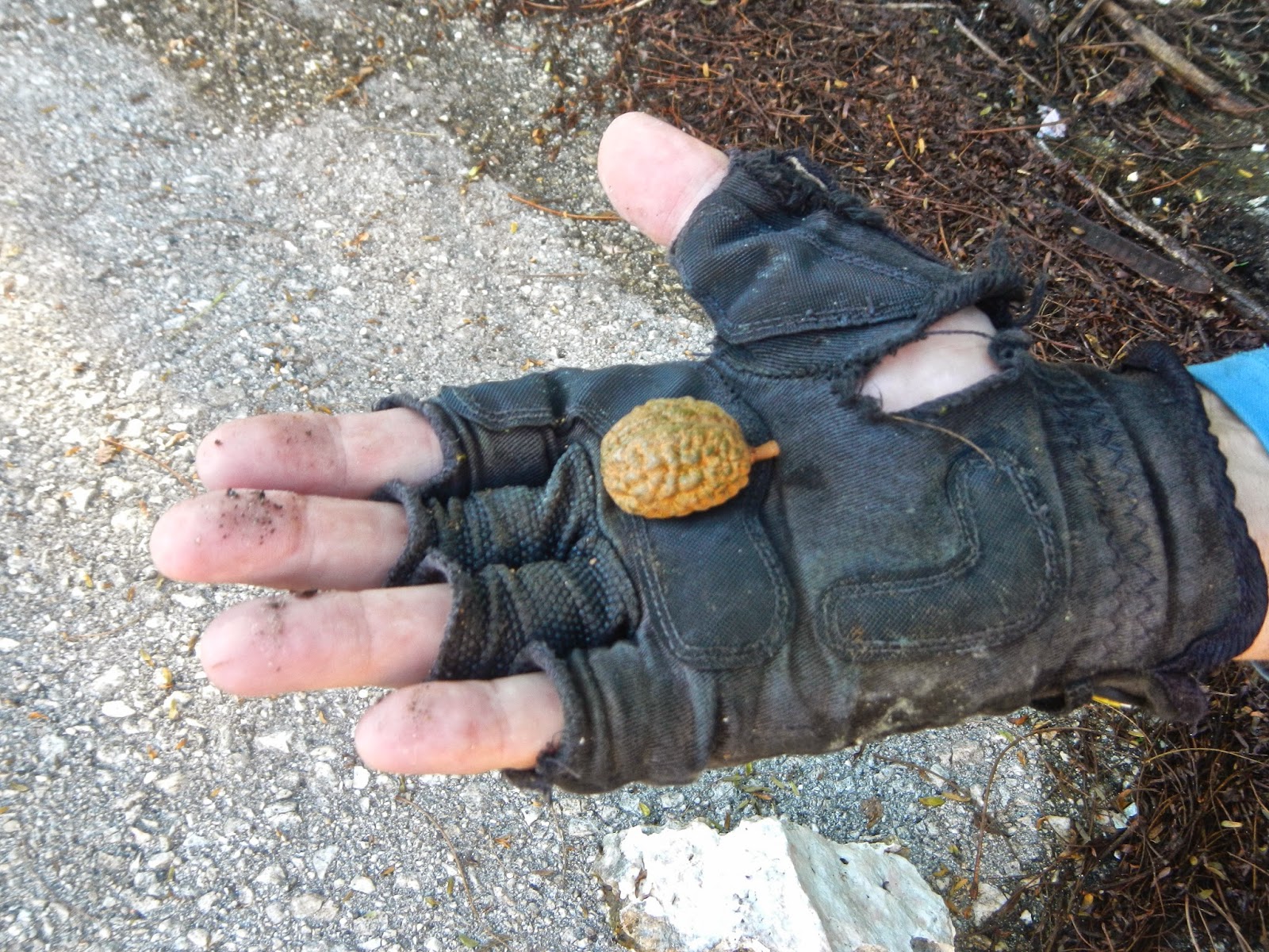
Rexplorer holding a nut, we want to know what it is and whether it is edible.

The nut cracked open and shows the "edible" part.

Sparky decides to try out the nut. Fortunately he only bites off a little bit, then spits it out. Apparently it does not taste that good.

We begin our hike into the trail just north of the radar station. 

A crack between the rocks offers a view down below.

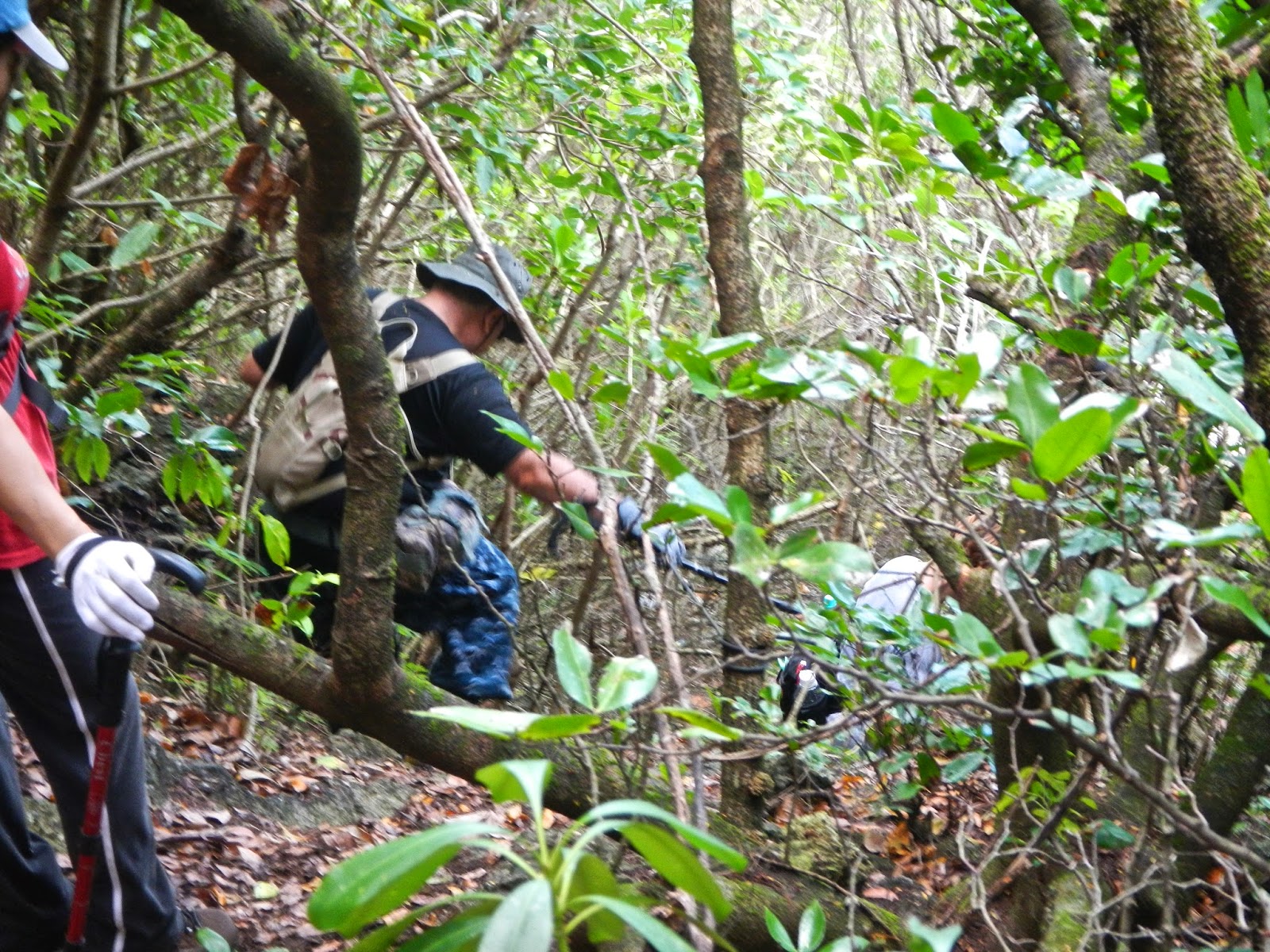
The trail, thick with jungle growths, begins on level ground, although Rexplorer, Ewok, Thor, and Sparky have to carefully step over hidden rocks covered by the undergrowth and fallen leaves.

Soon the trail starts to descend over boulders and slippery rocks. Here the going gets a little rough, but we are able to follow the ribbons and find ourselves back on the trail to Marker 1 of the Laderan Tangke trail. We decide to skip the LT and head back down the road to the car park.

Instead of going down the main dirt road back to the car park, we take a detour into the boonies on the opposite side, this area is very pretty with a lot of these red berry bushes.

We also encounter several of these posts along the way. The trail is marked and is very pleasant, and it soon leads us back to the main trail.

Back by the car park, Rexplorer, CC, Ewok, Thor. and Sparky in our traditional group photo.

Rexplorer takes this photo of us.

RunKeepers records our hike, as a short distance, but with a very interesting routing. This is one of our shortest hikes, but very enjoyable. CC burns just enough calories to eat a "small lunch"!


Monday, May 12, 2014

5/11/14 Naftan Exploration

During many previous hikes on the lower Naftan trail, we have noticed several off shoots from the main trail. Although we have made short jaunts onto these off shoots (fingers), we have not gone all the way through. So for our 5/11 Sunday hike, we have decided to explore these finger trails more thoroughly. We park at the Hawaiian Rocks road that leads to the upper Naftan trail. At 6:15, WonderWoman, Dora, Thor, Ewok, Rexplorer, and CC trek down the trail to begin our adventure.

On the cross-over trail, which is an old road that connects the two trails (also drivable roads). This trail has natural rock wall on one side and built-up rock wall on the other side to support the road. This is an area worth checking out some time in the future.

Midway on the trail is a large taotaomona tree, our favorite stopping point to take photos. Rexplorer takes this photo of us sitting gingerly on the fallen tree trunk, while Dora keeps a barbed wire away. Ewok, being the gentleman, stands behind the ladies. 

After we reach the lower trail, we turn toward Obyan to find the first trail. All the trails are heading toward west. On the first trail we run into several vines that have clusters of bojobo dolls eyeball beans. 

We are surprised to be walking on a long paved "sidewalk" and even a few concrete steps. Dora and WW receding down the walkway.


Imagine our second surprise when we reach the end of the first finger trail and come upon the Obyan parking lot! After taking a minute to look-see around, Ewok, Thor, Dora, and WonderWoman go down the stairway to the beach. Rexplorer and CC check out the large concrete foundation on the left and determine that it must have been some sort of recreation hall or mess hall.

Enjoying the view from Obyan Beach at Naftan point. We retrace our steps back to the main trail for the next finger.

A massive spider webbing shining in the sunlight.

Second finger comes to a deadend. Here the foundation is built with white "concrete" mixed with crushed "seashells". It is different from other foundations we have run across. Here also is rather trashy and the ground is strewn with many large rice sacks. From the deadened we return to the main trail and begin walking down the third finger.

We come to a cross over from the third finger to the fourth finger (there seems to be a continuation of the third finger, but the cross over is clearcut, so we cross over). Soon the finger comes to a drop off. Rexplorer, Thor descend first. Ewok, Dora and WW wait their turn. Here the fallen leaves create a nice soft field of brown carpet. 

Ewok takes his turn. 

Dora and WonderWoman make their way down carefully. There are several ropes to assist with the the steep drop down.

A beautiful white sand beach greets us at the end of the finger. Dora and Ewok busy taking pictures while Rexplorer and Thor admire the view.

WonderWoman happy to see this soft white sand beach with Obyan Beach in the distance.

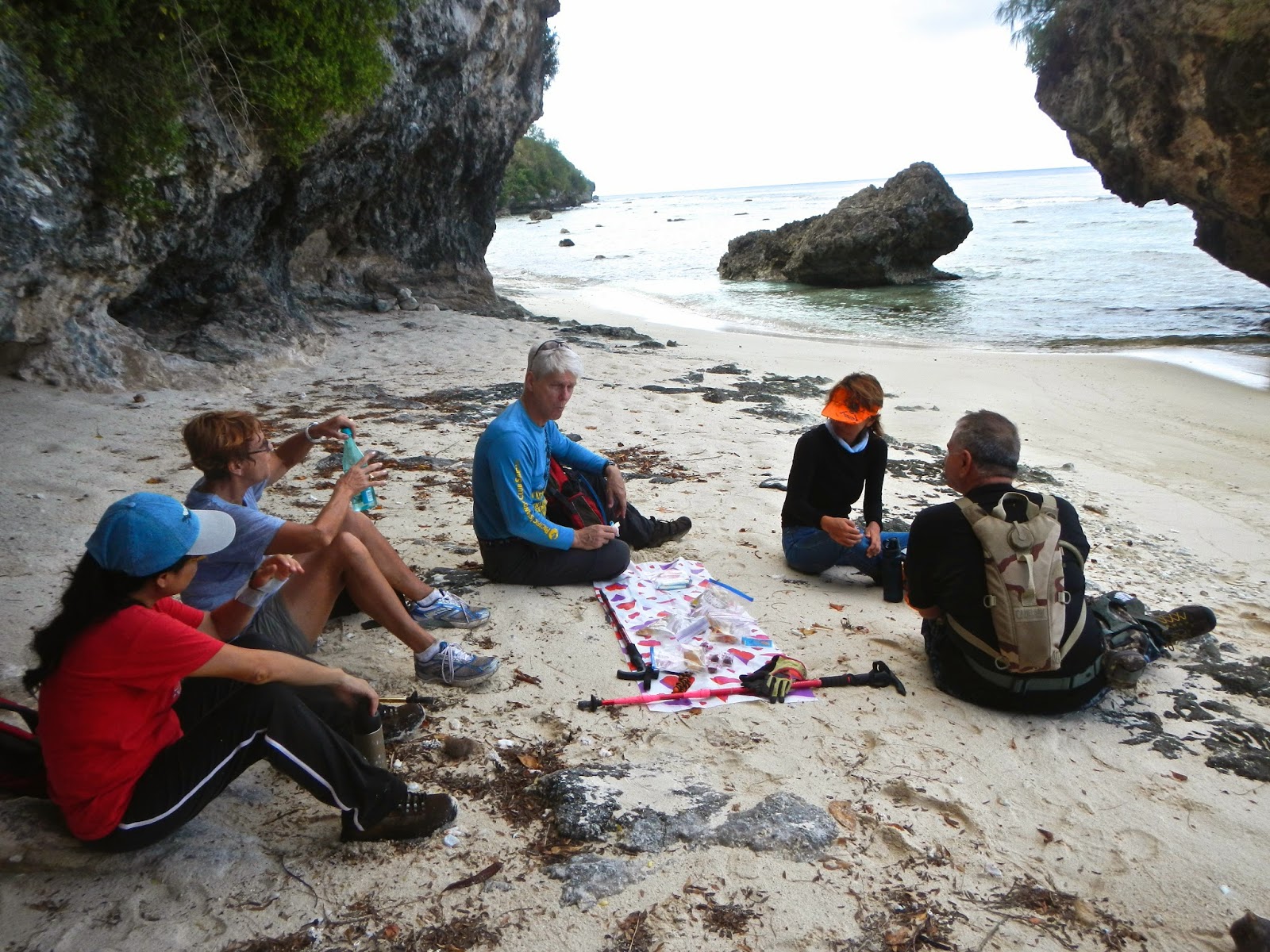
A perfect spot to have our snacks.

Either the camera is setting on a slope, or there is a strong wind that is blowing us sideway! 

One more finger, the fifth, leads us down another slope and a steep drop. Here Ewok, Dora, Thor and WW follow Rexplorer who is already down below encouraging everyone to "ComeOnDown!"

Ewok decides he has had enough of roping down another steep drop. He sits and waits for the group to return. Thor decides to wait as well.

A shallow cave at the bottom. Looks like a shelter of some sort.

The rest of us are on the beach which is an extension of the same beach at the fourth finger trail. It is still white sands, but not as wide. Just beyond the reef is a dive boat.
We return to the lower trail, satisfied that we have discovered the very interesting five fingers, and will most likely return in the future.

On the way back, we encounter another hiker and stop for a short chat. From here it's an easy hike back to the car.

RunKeeper shows that we have hiked 5.62 miles in 3 hours, 37 minutes, and 32 seconds. The 2-mile marker is the first finger that leads us to Obyan Beach. The 3-mile marker actually covers the second, third, and fourth fingers. The fifth finger is the very bottom curved trail to the water. 
It is a great hike, worth five sneakers!


Wednesday, May 7, 2014

4/27/14 Naftan Cave & 5/4/14 Kannat Tabla

4/27/14 Naftan Cave

With several hikers missing the fabulous Naftan Cave the last time we went, we decide to make a second hike there for Sunday, April 27. We meet at the Obyan Beach parking lot in order to go to the cave directly from the lower trail. If we have time afterward, we plan to explore several of the side paths from the main trail. 
At 6:15 a.m. we meet at the parking lot: Thor, Sparky, Cutie, RedEye, Chops, Rexplorer, and CC are ready for the trek.

First order of business is to announce the winner of our last Guessing Game. With precision accuracy, Sparky wins the prize. The grab bag offers several items and Sparky picks this little bag of incense, as he shows off to Thor and the group. 
His winning answer for the Seven Samurai: (L to R) 
WonderWoman, Karen, Ewok, Sparky, Thor, Cutie, Chops.
Way to go, Sparky!

Handy must be really desperate to want to steal this old tire from Doug's car!! But we find out that he is actually stretching his back before the hike. From here we climb back up to the rocky Obyan Road and the lower trail.

Entrance to the cave is not for the faint-hearted or those who are about to leave town and not willing to risk injury. RedEye and Cutie opt out of going down the steep drop, as they are leaving in two days. They promise to try the next time we visit the cave. Thor nimble-footed down the slippery rocks first. Rexplorer goes down to prepare assistance to Chops who is delighted to make it safely down.
Rexplorer returns to the trail to join RedEye and Cutie as they plan to explore the side paths on their way back to the car.

Sparky appearing from the second drop off onto the floor of the big cave. With the top open to the sky, it is more like a grotto without water.

Chops scrambles up toward the window of the upper chamber.

With the roaring water crashing against the rocks below, Chops is inspired to pose as a mermaid.

CC and Thor taking a break at the edge of the upper chamber. Just beyond is a straight drop to the channel with Tinian within eyesight.

Sparky singing?

After our usual snacks and relaxation, we make our way back down the very slippery rocks.

Going back up the drop off is much easier than going down. Sparky follows Thor and Chops, with CC bringing up the rear.

One of the disturbing sights we see around some of the island trails.

We see A nice herd of cattle and a friendly "cowboy" on our way out of Naftan.

Although we lost three of the hikers, the four of us had a very nice time. We did not have time to explore the other side trails, which we reserve for a future adventure. Four sneakers!

*****************************

5/4/14 Kannat Tabla & S.O.M.

Another hike that we have talked about for a long time is the one going down to Kannat Tabla from Tapochau. Not knowing how long the trail is and where it ends, we have hesitated taking it. But having hiked the Sound of Music two weeks ago, we decide to expand our horizon and try the "new" trail. We meet at the Coral Isle Condominium lawn off Mt. Tapochau Road at 6 a.m.: Bruiser, Sherpa, Thor - Sparky sick :-(, Ewok, WonderWoman, Rexplorer, CC are joined by Chris, Miles, PT Shelley, and dog Winnie. We walk up the road to Waserak Dr. 

WonderWoman, Sherpa, Bruiser, and Rexplorer take a short break on Waserak Drive. This portion of the road is still dry.

One section of Waserak is lined with coffee trees. Here is a cluster of coffee tree flowers. 

Under the umbrella of bamboos, Miles and Dad and Winnie enjoy this beautiful forest. The ground is very slippery as we negotiate over rocks and pebbles.

Soon enough we are out of the protection of the thick forest and onto the muddy dirt road. The road has been gouged out by large ATVs with giant wheels. Here most of us pick our way on the   raised median where it is slippery but not puddly. Miles, however, decides to take the puddle walk more seriously.

PTShelly and Thor approaching one of the muddiest portion of the road. Everyone's shoes are caked with thick mud.

Finally we reach the savanna and the road to Kannat Tabla. First we must have our snacks, which we all agree. Thor sits down to scrape off the mud on the bottom of her shoes. This is our  group photo minus CC the photographer: Thor, Rexplorer, WonderWoman, Bruiser, PTShelly, Sherpa, Winnie, Chris, Miles, and Ewok.

Ewok admires the view while Rexplorer confers with Thor, PT, and Chris. From here PT, Chris, Miles, and Winnie decide to forego the Kannat Tabla hike, and return to the car by way of Sound of Music, thus avoiding the same slip and slide of Waserak.  The remaining six of us continue down the trail to Kannat Tabla.

The view of Susupe below. 

The trail is wide and steep. We come to an abrupt dead end, where a chain is placed across the road that leads to an ATV business. The picnic table marks the end of the trail. Although we could continue through the property, we decide against it, and instead, turn around back up the    trail.

Back on top of the hill, we look for the well hidden trail back to Sound of Music.

Back on the boonie trail with WonderWoman, Bruiser, Sherpa, Thor, and Ewok.

On the woodsy trail are several LANTANA bushes, native of Americas and Africa, having been  introduced to other areas, such as Saipan. It is an invasive shrub that has leaves that are somewhat poisonous, but seeds loved by birds. It has many varieties of colors (see below), but on Saipan, the red/pink/yellow type is most common.
The many different colors of Lantana.

The temporarily opened trail for the recent Xterra race is slowly growing back. The steep trail makes this section a challenge as it slowly leads back up to Mt. Tapochau.

CC and Bruiser have their heads wrapped to keep the sun away. The hill in the background is where the hikers have been earlier.

Sherpa, Bruiser, and WonderWoman celebrating with their arrival at Sound of Music. The climb up from Kannat Tabla to here has been a challenge.

Tree moss growing on ironwood trees on Sound of Music. 

After waiting for a while, Thor and Ewok join us by the big shaded trees. Ewok eases himself under the tree and appears to need EMO assistance! :-) From here on, the trail is much more kind, and we will soon be on the Mt. Tapochau Road, having climbed all the way from Kannat Tabla. 

The top of Mt. Tapochau is to our left as we approach the main road. We hear greetings from above, and see that three people are working near the top of the cell tower. 

Bruiser, Sherpa, and WonderWoman on the long, hot stretch of open road. Even though the sky is overcast, and the breeze reasonably pleasant, this final downhill trek is the most punishing part of the hike. Champagne brunch is on their minds as they speed down the mountain to their cars.

Seven miles and 4.5 hours of mud, grime, and lots and lots of uphill climbs, we loved the hike! It is FIVE MUDDY SNEAKERS!