Wednesday, April 29, 2015

Kimikaze/Bird Island

Six hikers meet up at the trail head of Kimikaze, albeit a little later than 6:00 a.m. One of Cutie's friends from Japan decide to join the hike with Cutie, the others and RedEye will join us at the beach. Thor and Sparky, suffering from fatigue, decide to skip the hike. 
The sun is out and the group is excited to get going. The trail is quite open and "groomed", so we have no trouble keeping up a good pace, although the recent rains render the trail a little muddy and slippery. 

Kiko is busy taking lots of photos of exotic flowers and plants on the trail. Ewok waits patiently.

The fern forest is particularly lush and green, enjoying the moisture. But we feel the humidity heavy in the air.

At the end of Kimikaze, we continue across the road onto Autobahn trail. The trail is still well marked and easy to follow.

This powder-puff is the flower of a Tangan-tangan tree, called Haole Koa in Hawaii. It has a very subtle fragrance. The tree bears a huge amount of seed pods that spread new plants generously all around. 

At the end of the first segment of Autobahn is the Bird Island trail. Here we find spread out on the ground a tarp with bird watching and catching material. We have run into the official bird counter who has set out a very fine mesh net along the Autobahn trail. We would not have noticed it if she hasn't informed us to be careful. In fact, CC's backpack is caught by the net. The birds are caught, tagged, studied, and let go again. We have run into the bird counters on Laderan Tangke in the past as well .

At the parking area of the Bird Island trail, we are met by Kami and Sachiyo accompanied by RedEye. Chops and Sachiyo clowning around.

Kami carefully slides down the steep drop, with the help of a rope. Due to the recent rain, the slope becomes quite ready for slip-and-slide .

After the slippery slope we are faced with a narrow ledge leading down to the beach. Here the going is a little rough.  

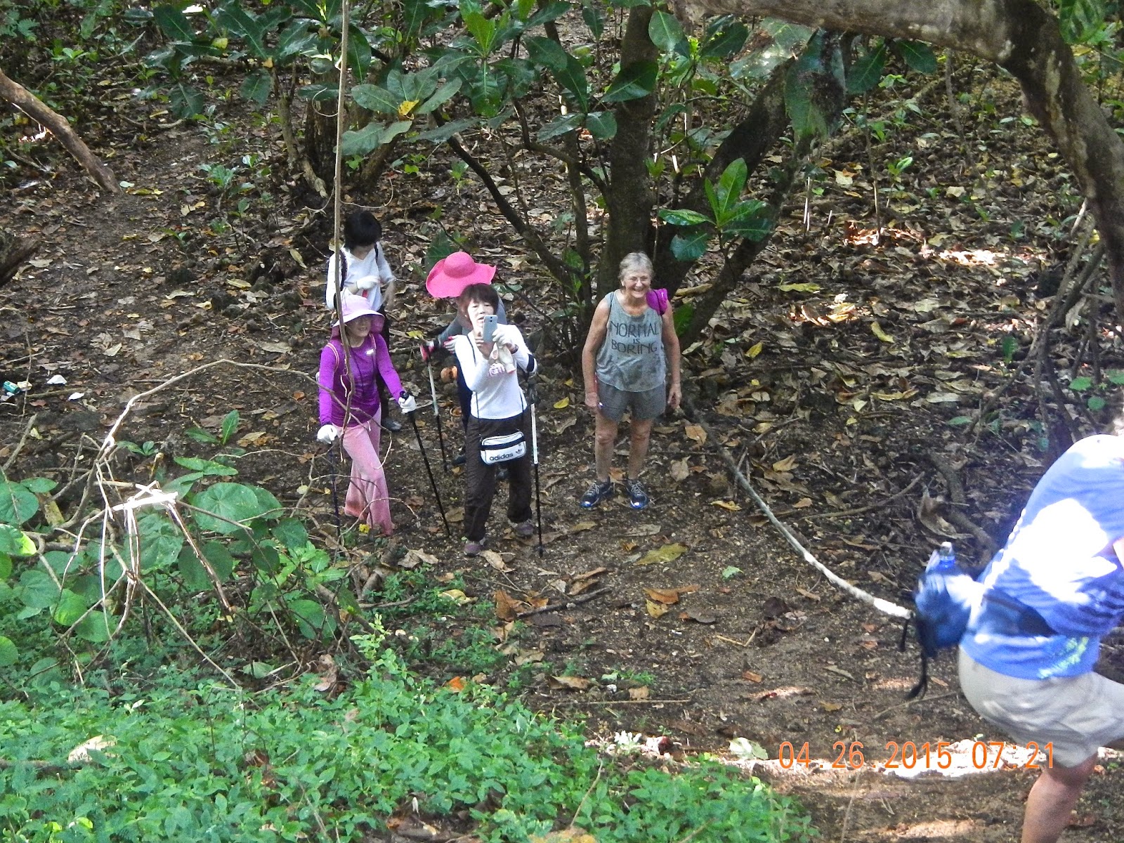
 With Cutie leading the pack, CB helps Sachiyo make the difficult negotiation along the narrow trail. Kami, Kiko, Chops, and Ewok wait their turn.

One last steep descent to the beach. Kami holds onto the rope. 

Cutie, Kami, Kiko, Sachiyo, and CB watch and record Chops skillfully maneuvering down the slope.

A repeat performance by RedEye. 

Looks like CB and RedEye are doing a do-si-do!

Girls on the beach! CB, Kami, Sachiyo, Kiko, Cutie, Chops and CC on Bird Island Beach, with Bird Island in the background.

We find a nice palm shade to spread out our goodies. Despite being frightened by the appearance of a gecko, Sachiyo appears to have enjoyed the snacks and company.

A sand crab camouflages against the coral beach.

Group photo under our shade tree. Bird Island in calm sea. CC, Cutie, RedEye, Ewok, Chops, CB, Kami, Sachiyo, Kiko. It is a beautiful day on the beach, everyone is happy to share this special morning with the visitors.

After the beach visit, everyone except three hikers decide to get in the car with RedEye and make short the hike. 
Exhausted CB rests at the end of Kimikaze trail head with CC and Chops.
It is a short hike of 2.89 miles (less than 2 for the early departures), although the uphill return is somewhat challenging. A great hike for scenery, cardiac workout, and fun company.


Wednesday, April 22, 2015

Banaderu Trail

It's time to climb up to the top of Suicide Cliff. The best way is to take the Banaderu trail and scale the steep slope. It is not a long climb, but the steepness is always a challenge. During rainy season, the trail can be very slippery, especially if one accidentally steps on the tree roots. 
With the dry season upon us, we figure it is a good time to visit the trail. Our recollection is that the trail is well marked, so we should not get lost the way we used to before the ribbons are tied to the trees. Sunday morning at 6:00 a.m. five of us meet at the parking lot next to the Korean monument: Cutie, Chops, CB, Rexplorer, and CC. 

As the morning sun reflecting a warm orange glow on the big rock, Chops, CB, Rexplorer, and Cutie stroll toward the bougainvillea bushes near the trail head.

The entrance may look confusing, but actually the white ribbons are very visible, and the trail is well marked. The ground is level but rocky, so we have to tread carefully.

Soon enough we start to climb straight up over jagged rocks and numerous tree roots. With gloved hands, we are able to haul ourselves up, using tree trunks, roots, and our poles for assistance. We also have to follow only the white ribbons and not be distracted by ribbons of other colors which lead to other parts of the mountain side, not to the main trail.

Part way up the mountain, we come to our favorite resting spot at the Sitting Tree. There is a cave on the left, and a big rock on the right, with a sturdy big root for Chops and Cutie to sit comfortably on to enjoy the first ocean view.

A free standing rock looking much like one of the famous karsts in Guilin, China. While resting at the Sitting Tree, we can take a good look at this large rock.

Having had a good rest, we continue climbing. Here Chops "shoe up" on the first set of concrete steps. Not sure if these are pre- or post-war construction, with visible rebar support.

Replorer at the first overlook. From here one can see the road and the water beyond.

CB and Rexplorer sharing a photo, and a common ancestry...

Another series of concrete steps near the top of the climb. CB following Cutie up these steps.

A surprise find right on the trail. This old canteen could be a war relic. It could've been covered by leaves and branches until the recent storm uncovers it.

Cutie and Rexplorer take some time out to discuss important issues.

Few mushrooms or fungus are seen on the trail despite all the rainfalls in the past few months. This pretty fungus is on the ground attached to a broken tree branch. It looks like the fungus called "turkey tail".

Rexplorer and Cutie on the last series of steps that look like the original old stone steps. After this the trail levels off.

CB and Chops clowning around.

A slab of concrete next to the trail bears this carved message: "Watch Your Leggs"!!?

A giant patch of Cadena De Amor covers the entrance to the flat ground and the trail to the top of Suicide Cliff monument.

An opening seems to lead downhill, so Rexplorer goes down to check it out. The clearing ends with thick boonies.

A piece of old rusty metal that looks like maybe shrapnel from a bomb.

Another clearing that opens up a clear view of Marpi below. Cutie, Rexplorer, CB, and Chops are all curious.

Whether by storm or by human work, several concrete slabs appear in the boonies. Chops starts to clear off the debris of leaves and branches to reveal what is underneath. Cutie watches closely.

This slab says LOVE with a cross on top of the letter "O", and an arrow pointing out of the letter "E".

More carvings on this slab.

From the top, a clear view of the veterans cemetery, the surrounding boonies, and the shoreline.

At the top, we eat our fill of the snacks, and enjoy the quiet surroundings. 

Four ladies sitting prim and proper for a photo shoot, CB, Chops, Cutie, and CC.

Ladies turn devil-like, except for Cutie, still lady-like!

Instead of walking down the main road back to the bottom, we retrace our steps and scramble down the cliff side. Going down is harder on the knees, and we actually sweat more than climbing up.

Using our favorite technique in going downhill, Cutie does the butt-walk. We make good time coming down, taking only 45 minutes to get back to the car.

The distance is short, a mere 1.6 miles, although we spend nearly three hours taking our time exploring, enjoying the balmy weather, the beautiful view and good company. A four sneaker hike...