Wednesday, June 17, 2015

The Longest March

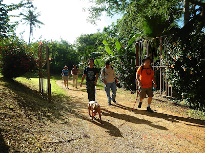
Despite forewarned about a long and hilly hike for Sunday, ten of us gather at the Kosacks' driveway to take on the challenge. Cutie and RedEye will be leaving right after the XTerra trail to meet a prior commitment, Rexplorer and Sukha dog will also return around the lime tree. The morning is clear and cool. We wait for a few more minutes in case anyone else may show up.

Ten brave souls (and two dogs): Sukha, Rexplorer, CC, Sony (friend of Scout), Indie, Scout, Boy, RedEye, Thor, Cutie, Chops, Sparky, in the glorious golden morning sun.

Less than ten minutes later, we are standing on the knoll looking back at the starting point, and the view of the golf course and the ocean.

Indie and RedEye taking big strides on the recently cleared XTerra trail.

Nearing the end of the trail, Chops, Sony and Scout enjoying the wide boulevard.

Rexplorer and Sukha ready to bid the group farewell before they run into the other dogs at the farm. RedEye and Cutie will also be leaving soon. From here the rest of the group walk past King Fisher golf course, up Talofofo Road, Egigi, and McDick Trail. The morning is still fairly cool and breezy when we come to the Guerrero farm.

Enterng the gate of the farm.

Chops, Indie, Thor, Scout, and Sony wait at the farm entrance while CC goes to ask for permission to walk through the farm ground.

Sparky admires the big farm and the variety of vegetables being cultivated.

A pretty bitter melon almost ready for picking.

Scout and Boy.

Thor, Sparky, and Indie strut through the farm.

The old bridge in Bananarama is barely strong enough to hold each person crossing it carefully.  Indie is the last one to make the crossing.

We come across a mango tree loaded with ripe mangoes. A sharp knife is produced for Scout to slice the fruit for sharing. 

Sparky, Chops and Thor enjoying their mango.

Indie takes his turn to peel a few delicious mango for sharing. Thor and Sparky are thoroughly enjoying their treats. (Nothing for Boy?) We all agree this tree has one of the most juicy and sweet mangoes we have ever tasted. We feel very lucky to have stumbled onto this surprised find. We are at about the half way point of the hike and this treat comes none too soon.

Setting up our snack "table" in the middle of the trail, we have a veritable banquet, even an open face sandwich of dark rye with salami, cheese and spicy pickle. Mochi, chocolate, fruit, crackers, etc. complete the snacks to prepare us for the long haul back.

Radar Hill

Back on Talafofo Road, we endure a long uphill hike, reaching one level area before climbing again. Here Sony, Scout, and good dog Boy keeping to partly shaded side of the road.

Finally we reach the Camacho farm. Scout buys everyone a coconut water drink. It is a most welcomed thirst relief. We are now ready to march up the last mile up XTerra trail.

Mission accomplished by seven: CC, Chops, Sparky, Thor, Indie, Scout, Sony, and Boy achieve the longest hike we have done. 8.72 miles in 5.03 hours (minus time for snacks and drinks). Fortunately, even though the sun is out, there is enough breeze to keep us cool from the burning heat. We are all very proud to have completed this practice hike. 

PORTRAIT GALLERY

Thor savors every bite of the sweet mango.

Scout proudly displays his sun shade.

Mr. Camacho, provider of coconut waters.

Indie and his famous hat...


Wednesday, June 10, 2015

San Roque Caves

A callout to hikers to join a walk in the woods, and to explore several caves along the cliff line in San Roque, attracts a good crowd on Sunday morning. We meet at the mini mart next to the Shell Gas station in San Roque at 6:15 a.m. After the owner of the market becomes quite upset that we are "blocking" his parking lot and his customers are complaining, even though no customers are in sight, we decide to placate the irate owner and drive the eight-car caravan to the San Roque church where we park across the street. 
We decide to start a new tradition of taking a group photo at the beginning of our hike just in case anyone decides to leave early during the hike and misses the after-hike photo.

Brian, RedEye, CC, Rexplorer, Giggles, Sparky, Thor, Rachel, Tina (two newbies), Ewok, Chops, CB, Cutie, Boy, and Scout. From the church we proceed towards Marpi St. and a grassy field.

Having obtained permission, during a previous hike, to walk through the field, we approach the woods. Boy decides to do a little sniffing while Scout wants to make sure he doesn't run off to check out other dogs in the area.

Rexplorer, Brian, and Scout trekking through some tall grass, and entering the boonies of Paradise Valley.

The thick forest is humid, with slippery rocks, roots, and fallen tree trunks. After Rachel scrambles under the tree trunk, Ewok bends low to follow, with Tina, Chops and others waiting their turns.

This gabion is one of two constructions found near the base of a stream bed, for erosion control to protect the village of San Roque. 

An "emotional" Chops reacting to the appearance of this large shell held by Ewok.

A collection of war artillery and ammunition.

What is everyone looking at?

Arriving at the first cave, Rexplorer gives a little lecture and background of the cave and its significance. 

 
Rachel leading the pack, with Tina, RedEye, Ewok, Chops, CB and Thor following up the slope to the cave. The ground is covered with soggy leaves and slippery rocks.

Then comes the very steep approach of loose sand and rocks, where four "legs" are better than two to make it to the top to see the iron gate.

This is actually considered as the Last Command Post where the last commander General Yoshitsugu Saito held out until the end. When he was wounded by shrapnel, he committed Sepuku, and his assistant completed his suicide by shooting him in the head instead of the traditional beheading. His American counterpart, Holland Smith, gave him a funeral with military honor.

The entrance of another cave.

This cave overlooks the cave above. Tina is standing on the edge of the window looking down and out. Others are inside the cave, with Rexplorer at the entrance.

While Ewok and Thor are busy taking photos, others are looking around, Tina is posing prettily for photo op, earning herself the hiking nickname of "Cover Girl". Welcome...

Carefully exiting the cave.

Sparky climbs up on one of the ledges, and looks down for a safe descend. After caving, we continue further into the valley to explore some more.

Crossing this large and mushroom/moss covered tree trunk takes some agility in the limbs. On the other side is a deep drop, so Chops has to scoot over for a better landing, while RedEye shows his flexibility.

Finally we find a bright spot in the thick jungle and it's snack time.

After snacks, we turn around and back to our cars. Some of the hikers take the grassy field, and some of us take the original trail through the boonies where we find this bomb. The bomb is about 14 inches long and broken into two.

An old flame tree with an unusual fin-like trunk shape. 

Further down the trail, another bomb is located. This one is about two feet long and intact. Also scattered about are ceramic shards and various metal pieces. This area is the last battle ground.

 
All is present for the final group photo: Cutie, RedEye, Thor, Rachel, Sparky, Rexplorer, Ewok CC, Brian, Cover Girl, Giggles, Chops, CB, Scout, and Boy.
This three-hour hike is short and sweet, with a whole lot of exploration. Everyone agrees it is a five-sneakers. 

Mushrooms Gallery
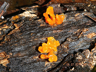
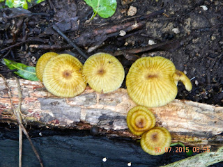
We have found more mushrooms in this hike than most of our hikes so far. The damp and humid atmosphere in this jungle area is perfect for mushrooms to thrive.