Wednesday, April 24, 2013

Kalabera/Nan Madol

We decide to take an easier hike on Sunday, April 21, before Handy and Cutie leave for their trip. Easier doesn't mean shorter, as we will go directly to the Serena Cave from the Bird Island lookout. From there we will double back to Kalabera Cave, and into the Nan Madol trail. 

On the way to the lookout, Handy decides to follow an SUV that he is certain belongs to Dora. We follow the car all the way to the top of Suicide Cliff only to find a bunch of tourists alight from the car. We go back downhill and arrive at the lookout just after 6 a.m. We enjoy the early morning scene while waiting for Dora and Jane as they have taken a wrong turn and have to find their way to the lookout. Handy gets into the car to find the girls, but they arrive and we regroup to start the hike.

 Great view of the Bird Island in early morning, with only one small family at the lookout, enjoying one of Saipan's best views.

The sun rises

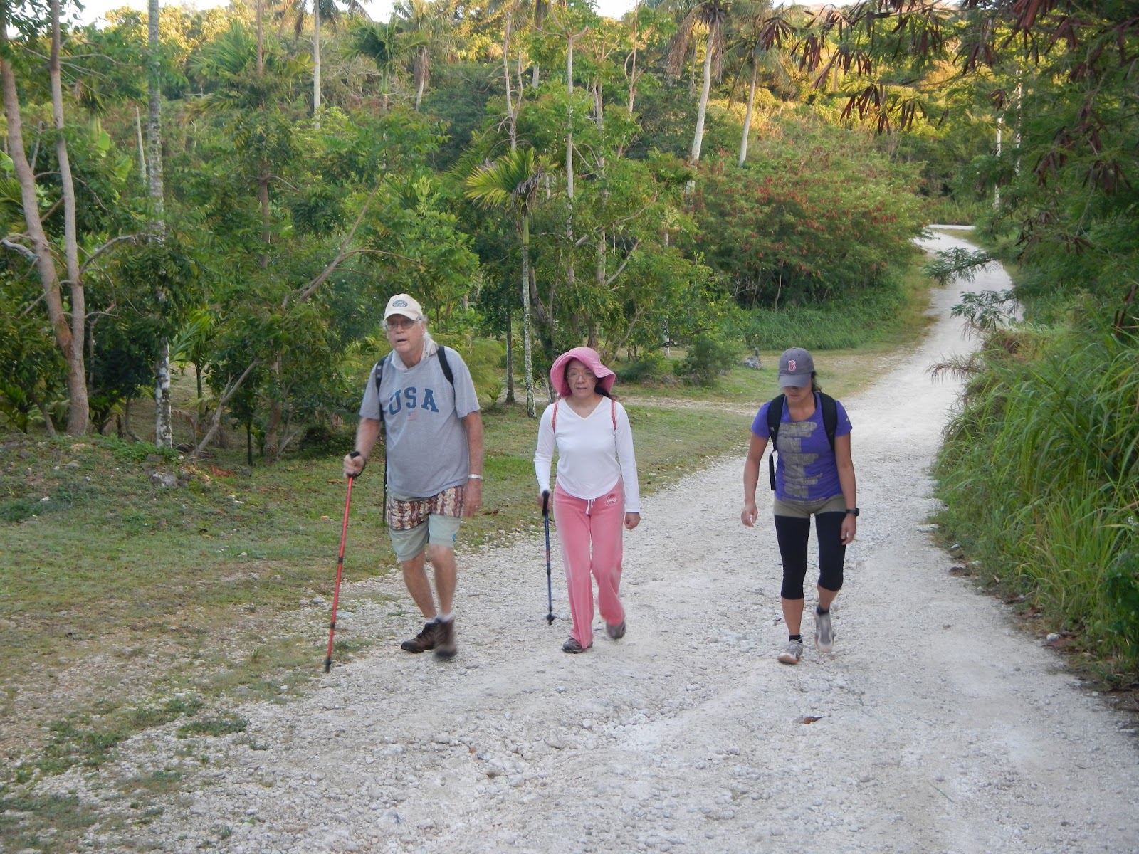
We are on the road to Serena Cave. Handy tries to fix Cutie's hiking pole while Dora waits patiently.

The trail leads us down a secluded boonie pathway deeper into the woods, with thick growth of trees, ferns, and rocky landscape. 

Heliconia plants growing thickly, but falling everywhere through neglect. But they still look healthy and gorgeous.

Finally we arrive at a very deep and dark Serena Cave. We don't dare getting too close to find out how deep it really is.

 Handy and Jane getting a closer look at Serena.

Time and weather have given Serena a look that is closer to a real mermaid, with green scaly tail, and leaves that resemble seaweed plants floating in the water.

We find many hieroglyphics on the rock wall in Kalabera cave. 

We are fascinated by the double profiles: a ghoulish old man on the left, and an orange faced female on the right.  

Another hieroglyphic on the rock face.

Jane sees the Nan Madol wall for the first time. 

We are on the right trail when we come upon the kapok trees. Jane picks up the white fluffy cotton.

Handy picks up a little plant to take home for his garden. We proceed to get lost in the woods, even though we know well that we are not really "lost", since we know exactly where the road is and we can hear the surf. But we need to find the trail that leads to the road, which we do eventually.

Back to the lookout, we run into a group of tourists making their stop at Bird Island. We ask one of the tour guides to take our photo.

This is an enjoyable hike. Not difficult, but fun to find new things and different views. We rate it a four-sneaker hike.

Monday, April 15, 2013

Egigi Japanese Hospital

Sunday, April 7, is our hike to check out the Japanese cave hospital set deep in a cave in Asteo. We really wish to show it to Jane, while Bruiser is getting ready to leave island, and she is able to join us when Bruiser drops her off at Handy's and Cutie's. We ride together to pick up Chops at the Post Office. Parking the car at the Tun Goru Cafe, we take the main road Isa Drive first to beat the traffic. Turning at Egigi Drive, we are on our way to the mysterious hospital.

Looking rather tired, Handy, Cutie, and Jane drag themselves up Gaga Karisu. The sky is clear and we anticipate a hot day ahead.

After passing quietly through the yard of the unfinished house, we are on the trail to the cave. Unable to resist a swinging good time, Chops and Jane find themselves hanging on for fear of breaking the seats. But they do look like they're enjoying it.

The last time we visited the site, this table was covered with ammunition, knives, swords and other war relics, this time, there are only the bottles left. We wonder what has happened to those historical relics. The rock pile behind the table looks interesting, and we wonder if it is a burial site, or just a pile of rocks.

Down the trail near the cave, there used to be a large bee hive buzzing with bees, we notice that the hive is gone, and only the base is left behind. We wonder, again, what has happened.

This is the only group of mushrooms by the trail. Later on, during the rainy season, there should be more mushrooms around.  

We arrive at the cave. There is a low wall that one has to climb over as one way to enter the cave. Jane can be seen standing at the alter at the entrance. The large rock behind the alter is the wall for the inner room.

Behind the rock wall is the hospital "room", or basically a large cave. A small memorial is set up at the back where visitors can burn incense and pray for the wounded and the dead.

Another way to enter the back room is by going around the low wall. Recent addition of the cairns built by visitors lined one side of the pathway.

This is the first time that the surrounding area is relatively dry and open. So we decide to explore the hillside. Chops stumbles across this buried bomb. After ascertaining that it is not a root, we carefully walk around it.

A little ways up the hill, another cave appears. Chops takes a look and finds it not too deep, but probably useful for storage.

Jane takes a picture of the long roots draping over the rock face like Medusa' hair. We notice that there is an opening between the two rocks. Curious as we are, we decide to climb up and see what is up there.

Jane and Capt. Charlie scramble up the rocks, and Chops brings up the rear.

From above the ledge, we see into the cave, although it is too dark to see the memorial site. 

We can see Cutie down below, through the foliage.

On the way out, Handy points out the bullet holes clearly visible on the rock wall. One can imagine the challenge the hospital faces with bringing the wounded through a very difficult path and dodging bullets at the same time.

A few of the medical items remain on this nook. Once more, previously there have been more items displayed, but unthinking visitors have selfishly taken these items meant for public viewing only. 

On the trail, we check out a gun placement mount, without a gun, that overlooks another trail below. We have planned to explore that trail at a later date.

Continue from the gun mount, we trek into the boonies above the other side of the cave, The ground is very flat and has a good view of the ocean. We can also see the entrance of the cave across the trail down below.

A fierce looking vine with huge thorns that can inflict painful cuts. We look for the leaves of this vine for identification. But no luck in finding any leaves. 

After this most fun exploration of the cave hospital, we are ready for a snack break before the long hike back to the car. L to R: Capt. Charlie, Chops, Handy, Jane, and Cutie.

We have had several visits to this cave hospital in the past, but this time we spent more time exploring the surrounding areas and made plans to return for the other marked trails. We rate this hike a five sneakers...

Saturday, March 30, 2013

Farm Trails

With Handy, Cutie, and Dora off island, Giggles and SpiceGirl entertaining visiting family members, Sunday hiking depends on the four die-hard members: Chops, Jane, Bruiser, and Capt. Charlie to finally take the long awaited hike through the xterra farm trails. We anticipate a long, although not hilly, trek from CC's driveway to Talofofo Road, Egigi and into the farm land.

A pink streak of morning cloud captures the rising sun rays. The dark clouds above look ominous and we full expect rain showers somewhere along the way.

The Xterra trail is surprisingly wet and slippery. At the detour on the trail, near the collapsed portion, Chops takes a slip-and-fall, and appears unhurt and quite happy to land on the soft soil. The rest of us take notice.

After witnessing Chops' graceful fall, Jane and Bruiser make their way carefully down the red mud. 

Evidence of Chops' fall. The rest of the trail is relatively dry. We look for the mango tree, without success.

Glorious sunrise near Camacho's farm.

Onto Talofofo Road. This newly uncovered cave is one which we believe is opened by the group of "cave searchers" recently visiting the island. We decide not to explore this cave today. From Talofofo, we turn into Egigi, past the Babauta ranch. As we are busy talking, we continue on Egigi until we realize that we have missed the turnoff to McDick trail. We back track to the V junction and start on McDick.

The old rickety wooden bridge on this trail has been replaced with a new model, courtesy of PIC. Jane wants to make sure we are aware of this strong new bridge.

After McDick, we are in the Guerrero farm land. We are impressed by this group of healthy looking beetle-nut trees.

Right after the ranch, we enter Ho Chi Minh trail, characterized by the farm land trails. We are really impressed by the hugely expanded farm acreage, beautiful vegetables growing for as far as the eyes can see. Chops is checking out something on the ground.

Looks like sun-dried tomotoes!

cylindrical squash.

Very healthy looking corn stalks, much better than the ones grown in years past. CC has purchased some of the locally grown corn and finds them quite sweet and tender.

Cherry tomatoes hanging down like Christmas ornaments. Currently it is tomato season, and one can find firm and sweet tomatoes in stores and farm stands.

After leaving Ho Chi Minh, we re-enter the boonies and come upon Bananarama, where giant size banana trees dominate the landscape. Jane and Bruiser demonstrate how tall the trees are.

Bruiser sticks his new tongue out. 

We decide to have our snacks before hitting Egigi Road again. The rest of the hike will be on Egigi, Isa, and Savana. We find the large mango tree and spread out our goodies. After filling our tummies, we feel much better. The weather is cool enough so the rest of the open road hike is, although long, not too hot.

A group photo at the driveway. Jane thinks this look like a high school photo shoot. But is CC really that short? Of maybe Chops is just really tall!

This is another long hike, totaling four hours and forty five minutes. Since there is no getting lost, or climbing up boulders, exploring caves, or any such adventurous events, it is still a most enjoyable hike, I think we rate it at least a four -sneaker hike.